 |
| Legio XIIII 'Gemina' make an opposed landing on Anglesey, c.60 AD - Angus McBride |
Last week, Carolyn and I decided to take advantage of the relaxed travel restrictions ahead of the May Bank Holiday to travel up to Pentre, a little village outside of Shrewsbury where we stayed in a very nice 'air bnb' to base ourselves for a little bit of exploring the delights of North Wales and the border area.
 |
| A little stop-off in Hay on Wye during our travel up to Pentre, where I managed to make a few additions to the library. |
With six months of lockdown we, like the rest of the country, were eager to get out and about and as this was a part of the UK that we both had places on our list we wanted to see, together with a lockdown habit of enjoying long walks, we planned to combine the two and spend a few days walking and exploring the area.
After driving up on the Sunday afternoon with a stop off in Hay-on-Wye, the book capital of Europe, where Carolyn indulged my curiosity to see what military history additions to my library I might discover, more anon, with some book reviews to follow, and a pleasant pint in the oldest pub in Ludlow only recently reopened for the return of visitors, we got settled in at Pentre; and then on the Monday our first day exploring took us off down the A5, London to Holyhead road, to Anglesey with the picture above by Angus McBride firmly lodged in my mind as I imagined seeing this last refuge of Druidism in Briton, before Seutonius and Agricola changed the history of these islands for ever.
The weather on the Sunday and Monday had been rather indifferent with drizzle accompanying our stroll around Hay and Ludlow and a chill-out day to follow, walking locally, which encouraged getting under cover to drink and read books, but for our journey to Anglesey on the Tuesday, God was in his Heaven and the sun shone bright amid azure blue sky as the temperature started to climb.
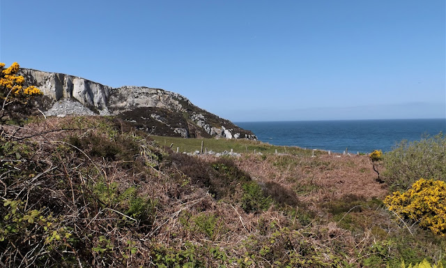
After crossing the Menai Strait, that separates the island from the mainland we continued on to Holy Island and Holyhead where we planned to check out the remains of Roman occupation and explore the last stop in Wales before reaching Dublin across the Irish Sea with the South Stack Lighthouse marking the last point of land and with a very nice four mile cliff walk thrown in before heading back to the Strait and calling in at an amazing Megolithic burial mound that harks back to the pre-Roman times on Anglesey and Britain as a whole, with Tolkienien descriptions of 'ruins in the landscape' and 'Barrow-wights' springing to mind with monuments like this no doubt inspiring his literature.
Caer Gybi - Holyhead Roman Fort
The 260 square mile island of Anglesey (Ynys Mon in Welsh) is situated off the north-west coast of Wales and is the largest island in Wales and the seventh largest in the British Isles.
It is linked to the mainland over the Menai Strait by the Menai Suspension Bridge designed by Thomas Telford in 1826 and the Britannia Bridge, built in 1850 and replaced in 1980.
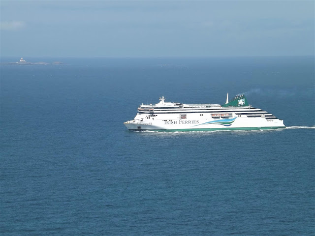
The principle town on the island is Holyhead on Holy Island with a ferry port that normally handles over two-million passengers a year travelling too and from Ireland.
The English name for the island is obscure, but it is referenced as such by Viking raiders in the early tenth century and later adopted by the Norman invaders of Gwynedd, however the Welsh name has a much earlier and established heritage, first recorded by the Romans in the Latinised form 'Mona'.
 |
| The Roman Conquest of Britain 43-84 AD https://commons.wikimedia.org/wiki/File:Roman.Britain.campaigns.43.to.84.jpg |
It is the Roman and early period of Anglesey that the island is famous for and historically associated with the last stronghold of the Druids in Britain and where their religion and influence was stamped out and crushed by the Romans in two invasions of the island in 60 and 78 AD, and places Druidism alongside Christianity as the two religions that were actively opposed and suppressed by Imperial Rome.
It appears not much of the early Roman occupation of the island is visible with the first century Roman fort at Aberffraw underneath the current village, excavated in the 1970's, revealing a thirteen foot wide V shaped ditch and earthwork bank, later added to with another similar U shaped ditch some five and a half feet deep with evidence of abandonment and another medieval ditch added at a later date, this together with some Samian pottery shards.
The above ground archaeology harks back to the latter days of Roman occupation as Britannia became the target for raids from Ireland and the Continent, requiring the building of coastal defence strongpoints and watchtowers ready to to repel such incursions, which I looked at in a previous post on a visit to Portchester back in 2017, built to repel raids along the Saxon shore.
The only remains of the Roman 3rd - 4th century fort in Holyhead are the familiar herringbone style stone and mortar walls that surround the church of St Gybi, with one long side of the enclosure overlooking the natural harbour.
 |
| British Campaigns of Agricola 78-84 AD https://commons.wikimedia.org/wiki/File:Agricola.Campaigns.78.84.jpg |
With walls almost thirteen feet in height and nearly five feet thick in places it makes an imposing footprint on the town with three corner towers, one original, still standing and with easy parking making it a great place to start our day tour.
 |
| A postcard showing the Dublin ferry SS Hibernia leaving Holyhead, later commissioned into the Royal Navy as HMS Tara and sunk off North Africa in 1915 https://www.dailypost.co.uk/news/north-wales-news/1915-sinking-hms-tara-hmhs-14867538 |
 |
| Another Holyhead Steamship, SS Anglia, seen here as a WWI Hospital Ship before her sinking in the Channel after hitting a mine, bringing injured troops back from France in 1915 https://en.wikipedia.org/wiki/HMHS_Anglia |
In Roman and Medieval times the harbour water would have come up much closer to the foot of these old walls, but today's modern harbour facilities lie beyond the main road into town and as you can see the day was set well for our exploring with wall to wall sunshine and blue skies.
Caer y Twr - Iron Age Hillfort/Roman Watch-tower
The rifling marks on the interior and the breech looking mechanism suggested a naval type of gun and later research shows the remains of gun mountings above the lighthouse so I came to the conclusion that this is one of those former coastal guns.
There is lots of wildlife evident in the area and among the birds spotted on our route back to the car was a very photogenic Stonechat that was very happy to perch close by and have his picture taken.
 |
| This little chap was certainly not camera shy and obviously photogenic! |
 |
| A real treat to end our walk along the cliffs |
The birds weren't the only ones enjoying the perfect flying weather.
Bryn Celli Ddu - 'The Mound in the Dark Grove'
We were feeling pretty tired by the time we got back to the car, but we still had one more place to visit before heading back to Shrewsbury for a well earned curry that evening.
Given the pre-Roman history of Anglesey we were really keen to see the evidence of those early inhabitants and there was one particularly interesting monument that lay close by our route back on to the mainland.
If you are interested in prehistory and the monuments associated with the megalithic and Neolithic periods then the British islands abound with burial mounds, henges and stone rows that give a glimpse into the lives of these ancient peoples, and you can check out previous posts on the blog that illustrate the many examples to be seen.
 |
| The Mound in the Dark Grove, a stunning way to end our day in Anglesey. |
Next up: More reinforcements for my Cape St Vincent Spanish fleet , then part two of this series of posts and I will have another War of 1812 book review to do.


No comments:
Post a Comment