In the last post in this series I concluded maters with our visit to the Eiríksstaðanefnd open-air museum dedicated to the former home of Erik the Red and our night's stay at our lodgings at Stóra-Vatnshorn farm, Point 12, before getting on the road to the Snæfellsnes peninsula on the western side of Iceland and if you want to pick up the previous post and the others that preceded it you can follow the link below.
 |
| JJ's on Tour, Iceland The Land of Fire & Ice, Part 4 |
 |
| https://commons.wikimedia.org/wiki/File:Map_of_the_Sn%C3%A6fellsnes_peninsula.png |
The volcano can be seen on clear days from Reykjavík, a distance of about 75 miles, and the mountain is also known as the setting of the novel Journey to the Center of the Earth by the French author Jules Verne.
 |
| Bolli Bollasson and other members of the Varangian Guard as depicted in the Osprey title by Giuseppe Rava. |
In addition to all this wonderful history the peninsula is also a place of spectacular scenery to delight one, that boded well for a few more memories of this trip before we were done.
These pictures capture the scenery along route 54, shown on the map above as we made our way along the northern coast of the peninsula on our way to the fishing and tourist town of Stykkishólmur.
A ferry called Baldur goes over the Breiðafjörður fjord to the Westfjords, and it is the gateway to Flatey.
The origin of Stykkishólmur can be traced to its natural harbour, and its location became an important trading post early in Iceland's history: the first trading post in Stykkishólmur is traced back to the mid-16th century, even before Denmark implemented the Danish–Icelandic Trade Monopoly (1602 – 1787), and from that time trading has been at the heart of the settlement's history.
From our vantage point I could see a local fishing boat hard at work close to shore together with the eider ducks and Icelandic gulls enjoying the placid waters of the bay.
 |
| Eider ducks were a constant feature and delight on this holiday, observable at just about every coastal location we visited |
 |
| The Iceland gull (Larus glaucoides) is a medium-sized gull that breeds in the Arctic regions of Canada and Greenland, but not in Iceland (as its name suggests), where it is only seen during winter. |
After a restorative hot brew and bun it was time to be on our way again heading for Hotel Snæfellsnes down on the south coast of the peninsula, but there was another spot we wanted to check out on the way.
As seen in previous posts Iceland abounds in waterfalls of all shapes and sizes and are a constant feature as soon as one ascends from the lower lying land as we were doing on our journey from the north coast to the south and when combined with the views from these high spots they are very compelling to just stop and enjoy the majesty of the place.
Its Icelandic name, Selvallafoss, comes from the nearby Selvallavatn lake, whose waters flow into the falls.
It’s not just humans that walk on the narrow trails around the waterfall. The lush greenery and fresh water are the perfect places for Icelandic sheep to graze, which is how the waterfall has come to be known as the sheep’s waterfall.
After checking in at our hotel we decided to finish the day by heading off a bit further along the south coast to Ytri Tunga beach and seal colony.
Located near a farm of the same name, Ytri Tunga beach is probably the best place in Iceland for watching seals, and just off the shore, on the rocks rising out of the water practically all year round, you can see at least a few individuals from the local colony.
When we arrived the tide was still out but coming in fast and several individuals were still happily beached on weed covered sand bars observing us observing them, but as the tide covered these resting places, the seals became more difficult to spot and so Carolyn and I decided to leave the tourist crowds now gathering and head off further along the path to quieter parts of the beach.
It doesn't matter whether it's seal watching, bird watching or any wildlife observing, the best way to see these creatures is away from other people and just being as quiet and inconspicuous as possible which is why I've made it a habit of dethatching myself from crowds as soon as possible.
The church is known for its beauty, both the building itself and the surrounding area, and is still used to this day, both for traditional church events for the parish, but also for weddings and musical events.
 |
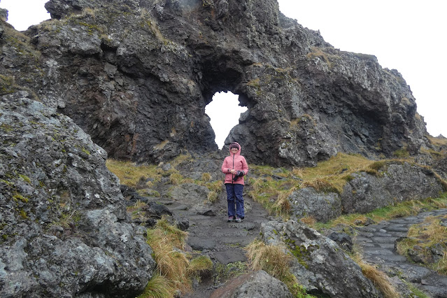
| Bárðr Snæfellsáss a half giant and the guardian spirit of the Snæfellsnes peninsula on the cliffs near the fishing village of Arnastapi and the eroded circular stone arch, called Gatklettur |
 |
| Gatklettur stone arch |
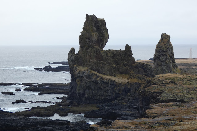
The rock formations created by these lava field cliffs, where molten lava once found the sea and then has been subjected to the effects of the elements over the intervening millennia are extraordinary and quite unlike anything we have at home.
 |
| The 140 foot trawler Epine, registration number GY 7 was built in 1929, seen here in WWII fitted out as an Admiralty minesweeper. |
 |
| Djúpalónssandur beach and cove seen from the top of the cliff path |
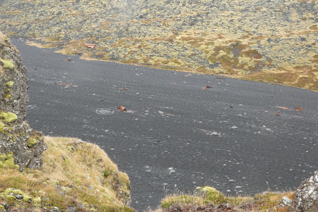 |
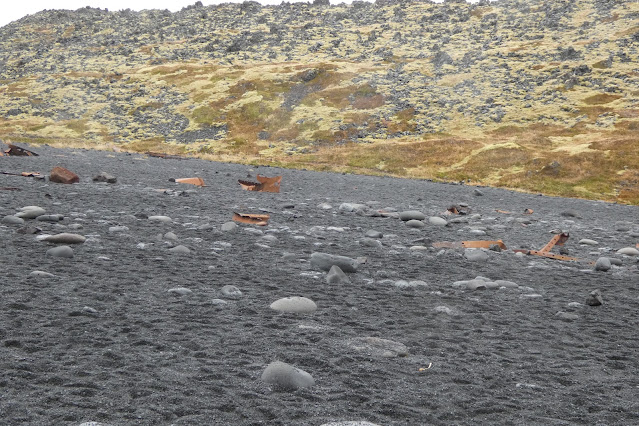
| Looking down on the wreckage trail across the beach of the trawler Epine |
In 1931 she was bought and sold to three new owners, eventually ending up with the Premier Steam Fishing Co. Ltd of Grimsby and renamed Epine and re-registered as GY 7, to be requisitioned as a minesweeper on the 3rd of September 1939 with the outbreak of the Second World War, as seen above with her gun mounted on the bow.
With the end of the war she returned to fishing duties in January 1946 and would tragically end her days on the rocks off Djúpalónssandur in a severe gale and blizzard.
An Icelandic rescue party got a line to the vessel and took four of her crew off, whilst one other crew member managed to swim ashore, but fourteen of her crew were lost as heavy seas swept the wreck.
Clinging to the bridge skipper Alfred Loftis was heard to shout
“I do not mind what happens to me so long as the boys are all right. Look after the boys”
“I do not mind what happens to me so long as the boys are all right. Look after the boys”
I have childhood memories of visiting the town and experiencing the delights of fresh caught Grimsby fish and know how important the industry was and still is to the town, serving as a major world fish processing centre today, employing some 6,000 people.
Our journey around this most beautiful part of Iceland concluded with a short drive to Kirkjufell , "Church Mountain", a 1,500 foot high hill on the north coast of Iceland's Snæfellsnes peninsula, near the town of Grundarfjörður, and claimed to be the most photographed mountain in the country.
Kirkjufell is a nunatak, a mountain that protruded above the glaciers surrounding it during the Ice Age, and before that was part of what was once the area's strata, composed of alternating layers of Pleistocene lava and sandstone, with tuff at its summit.
Our two days touring the Snæfellsnes peninsula simply flew by and although we got a lot of things included it felt strange to be loading the car to begin our journey back to Reykjavik in time to catch a flight home only two days later, with an overnight in the Icelandic capital giving us a bit of time to see some stuff we missed on the first two days of our holiday.
The Thetis-class ocean patrol vessels or ocean patrol frigates, also called Stanflex 3000, are a class of large patrol vessels built for the Royal Danish Navy, comprising four ships, all built and commissioned in the early 1990s; with the ships' tasks of mainly maintenance of sovereignty, search and rescue, fishery inspection and support to local (mainly Greenlandic) authorities.
Created by the Reykjavik City Museum, the exhibition is based on the archaeological excavation of the ruin of one of the first houses in Iceland and findings from other excavations in the city centre.
The focus of the exhibition is the remains of a hall from the Settlement Age which was excavated in 2001.
This black sand beach is also a beautiful part of the Snæfellsnes coastline and Carolyn and I lingered to enjoy the amazing rock formations that characterise the cliffs around this small bay.
 |
| Kirkjufell , "Church Mountain", a 1,500 foot high hill on the north coast of Iceland's Snæfellsnes peninsula. |
Kirkjufell was one of the filming locations for Game of Thrones season 6 and 7, featuring as the "arrowhead mountain" that the Hound and the company north of the Wall see when capturing a wight.
As stunning as this particularly eye-catching mountain or high hill is, to my wargamers eye, I couldn't help seeing the image of a certain hill at a certain battle field in South Africa , although Isandlwana hill is about three times higher, and certainly a lot warmer and dryer, but from a certain angle there are distinct similarities.
Kirkjufell is a nunatak, a mountain that protruded above the glaciers surrounding it during the Ice Age, and before that was part of what was once the area's strata, composed of alternating layers of Pleistocene lava and sandstone, with tuff at its summit.
Whilst enjoying the magnificence of Kirkjufell we witnessed what apparently drives a lot of Icelanders up the wall with tourists or what we would call 'Grockles' in my part of the world, namely the inconsiderate, if not down right dangerous, behaviour of just simply stopping ones car on a 90km road to allow the front seat passenger to take photos of an amazing piece of scenery suddenly seen from the vista of the car windscreen.
It was not as if a 1,500 foot hill like Kirkjufell can suddenly appear from nowhere to cause such an immediate pulling up to a complete stop, and of course there are multiple signs pointing out parking areas for such a pull in, but no, said 'Grockles' made a complete sudden stop and nearly had not one but two other cars join them on the back seat. Forgive them Lord for they know not what they do!
 |
| Back in Reykjavik on a rainy weekend, passing the time before catching our return flight to London Heathrow. |
The drive back to Reykjavik was uneventful as far as the weather was concerned, although we did encounter some very heavy rain en-route, stopping in Borgarnes for a spot of lunch and passing through the Hvalfjörður undersea tunnel, that runs 541 feet below the waves under the Hvalfjörður fjord, reducing the previous time when it was opened in 1998 to circumvent the fjord from one hour to just seven minutes in the tunnel.
Our two nights in Reykjavik was a time spent simply enjoying the sights of the town again in a very leisurely way, now knowing our way around much better than when we arrived, and a return visit to the port area revealed the Royal Danish Navy was in town with HDMS Triton F358 close alongside.
A regular visitor, the Triton, a Thetis class frigate, patrols these northern latitudes and is used to exercise Danish sovereignty over the waters around Greenland and the Faroe Islands.
The Thetis-class ocean patrol vessels or ocean patrol frigates, also called Stanflex 3000, are a class of large patrol vessels built for the Royal Danish Navy, comprising four ships, all built and commissioned in the early 1990s; with the ships' tasks of mainly maintenance of sovereignty, search and rescue, fishery inspection and support to local (mainly Greenlandic) authorities.
The operation areas are normally Greenland and the Faroe Islands, but the vessels also operate near Iceland on transit between Greenland and the Faroe Islands, and near Denmark.
The oldest timber building in Reykjavik is the iconic timber house pictured below, Aðalstræti 10, which was built in 1762. It was the home of Geir Vídalín, the first bishop of Iceland, Jón Sigurðsson, Iceland’s independence hero, and from 1926 until well into the 90s, it also served as a shop and then a restaurant called Fógetinn, until purchased in 2005 for extensive renovations to become part of the Reykjavik City Museum and housing exhibitions about the history of Reykjavík, including access to The Settlement Exhibition 871±2.
 |
| Aðalstræti 10, built in 1762, the oldest timber building in Reykjavik |
The old Silli & Valdi grocery store that occupied this old house from 1927-75 has been beautifully reconstructed and brought back lots of memories of similar business back home that in the main have been gradually replaced by the large superstores that have replaced them today.
The Settlement Exhibition 871±2. lies below ground level of the modern day Reykjavik as illustrated by the picture below looking up through the skylight over the remains of the hall that once stood here circa 930-1000 AD.
The hall was inhabited from c. 930–1000, and north of the hall are two pieces of turf, remnants of a wall which was clearly built before 871±2, hence the name of the exhibition. Such precise data dating is possible because a major volcanic eruption from the Torfajökull area spread tephra across the region and this can be dated via glacial ice in Greenland.
The hall is among the oldest human-made structures so far found in Iceland. Also on display are objects from the Viking Age found in central Reykjavík and the island of Viðey.
 |
| This 'finds' cabinet holds iron nails, some of the commonest objects found in excavations of Viking buildings in Iceland, together with several knives which were a common possession of that time |
 |
| A Viking key |
 |
| As explained below these are several items of wood, a material rarely found in Icelandic excavations due to the conditions for poor preservation. |
Below is the only fragment found of an Icelandic Viking-Age glass drinking vessel, something in itself that would have been a rare and costly article, and examples of which have been found in the homes of Viking Chieftains in other parts of Scandinavia.
 |
| Icelandic Viking-Age glass |
The illustration below shows what these glasses may have looked like and such vessels are believed to have been made in Southern Europe.
Keen to carry away a bit more of the Reykjavik vibe before our evening dinner, at which I enjoyed finally tasting some fresh caught Icelandic Arctic Char which was absolutely delicious, we made our way to the lake behind the Parliament buildings to watch the children feed the birds and to get some pictures of a particular statue or should I say monument.
No one could accuse Icelanders of not having a distinct sense of humour and if one was ever to compose a piece of art that so vividly captures the nature of the so-called 'deep state', the army of faceless civil servants that seems to have come to personify modern government then this has to top it.
The monument to the unknown bureaucrat is a clever caricature of the civil servant, similarly captured in the old British TV comedy 'Yes Minister' that contained many truisms about how government actually runs rather than how we might imagine it to be, and perhaps we should have something similar set up in Parliament Square to balance out all those of the 'Great and the Good'.
 |
| The monument to the unknown bureaucrat, behind Parliament House in Reykjavik, a clever caricature of the civil servant |
Carolyn and I had an extraordinary time traveling around Iceland and have taken away lots of memories that will be captured in our photo-book of the holiday that Carolyn pulls together with the best of our digital pictures printed in a glossy hard back to go with our other jaunts that can be browsed through in years to come, and I hope these posts might inspire others to book a date to explore The Land of Fire and Ice.
You wont be disappointed.
Next up, I have the latest additions to join my respective fleets, with some new frigate options from Turner Miniatures to add to my War of 1812 collection and a proof of concept build for some other ideas I have in mind.
More anon
JJ









I enjoyed your journey, which also invoked my memories of trekking in Iceland many years ago, thanks
ReplyDeleteHi, great, glad you enjoyed the read.
DeleteIt's always much more fun sharing the adventures with like minds.
Cheers
JJ