

It was back in 2017 that Mr Steve posted his report on his visit to Roman Silchester and ever since then it has been on my Roman tick list of places to visit, to go along with the other key Roman sites visited here in the UK and reported here on JJs.
 |
| JJ's Wargames - A Walk around Silchester with Mr Steve |
If you would like to check out the other posts on Roman Britain, I've put a list of links to them at the bottom of this post.
.jpg) |
| St Mary's Church in the centre of Old Amersham with the old Amersham brewery in the background. https://amershammuseum.org/ |
So it happened that on May Bank holiday the opportunity presented itself to visit Silchester on our way home, after a short stay in beautiful Old Amersham, on the outskirts of west London to spend time with a close friend and celebrate her 60th birthday, with the town almost replacing this post with a post of its own and the amazing history to be seen in its architecture spanning the centuries of English history
.jpg)
Amersham will no doubt feature in a future post here on JJ's, looking at its history and featuring as a base for some walks Carolyn and I would like to do in the area and in and around London, with this gloriously bucolic town, a perfect location to stay, with its multiple old pubs and mix of restaurants, as we discovered during our stay.
.jpg)
 |
| Silchester is about five miles north of Basingstoke in Hampshire, and about nine miles south-west of Reading, and has one of the best preserved Roman walls in Britain together with one of the oldest Christian churches. |
 |
| https://commons.wikimedia.org/wiki/File:Iter.Britanniarum.jpg |
The pre-Roman Iron Age town of Calleva was founded between 20 and 10 BC, not long before the Roman invasion in 43 AD, and the large bank and ditch close to the car park forms part of the original Iron Age defences.

Likely planned as a settlement of people who came from the north-west of Gaul (modern day France), around the town of Arras and the tribal centre of the Atrebates; the town became a major processing and trading centre for locally manufactured goods, such as horse and chariot gear, exchanged for metals, grain, slaves and other commodities from across southern Britain, and in return these were passed to the Roman world in exchange for luxury foodstuffs and manufactured goods.
 |
| A gold coin, excavated at Silchester shows the place name CALLE[V] and the name of king Eppilus, one of a succession of three kings who controlled an Iron Age kingdom extending across southern England. |
After the Roman conquest, the territory of the Atrebates retained some autonomy until the late 1st century AD, and at this time the Iron Age grid of streets and lanes was replaced by a regular grid laid out on a north-south and east-west orientation.

The Iron Age town was a thriving defended settlement, with buildings arranged on an organised layout, extending over most of the area of the later Roman town.
As per my normal way of illustrating the walks I do here on the blog, I have included an illustration of our route, together with key points numbered that I refer to with the pictures taken to give a better idea of where on a particular view we were standing at the time.


Given the time of year, the countryside was well into its Spring time colours and sounds, and we enjoyed the walk up to the western ramparts amid the purple haze of carpets of bluebells under the trees accompanied by the sounds of calling songbirds busy with nesting and from across the fields the sound of a distant Cuckoo, just arrived from Africa, and a sound I hadn't heard for a couple of years, but one that immediately alerts to the coming of summer.

 |
| A fantastic display of bluebells, along with the cuckoo, heralding the approach of summer |
 |
| A honey-bee swarm along the path up to the site |
As mentioned, the site is well signed and our path took us up to a small swing gate that is the entrance to it, and offers the visitor the choice to head up the centre of the Roman town across the fields towards the church, right along the western ramparts to the west gate, or as we decided, left along the corner of the north rampart and remains of the old wall, towards the north gate, Point 1 on the map above.

 |
| The route along the remains of the old Roman wall towards the north gate |
 |
| Spring lambs filled the nearby fields and provided another distraction as we made our way along the wall. |
 |
| The north gate as it might have looked in the 3rd century AD, after the rampart had been strengthened with a wall, guarding a carriage way, some thirteen feet wide, sufficient to allow a single cart to pass. |
The Roman town defences were built in two phases, starting in about 200 AD, when a rampart of earth and clay was constructed, together with masonry gatehouses, the remains of which, seen below are of the north gate.

The grassed-over remains of the ramparts are seen either side of the gate and in about 270 AD these defences were strengthened with a massive stone wall, offering general protection from enemies, whilst also regulating the flow and control of traffic entering and leaving the town, with single carriageway gates here and on the south side but with dual carriageway gates on the east and west, and with this gate controlling traffic arriving from Dorchester on Thames.

As per Roman law dictating the setting up of burial sites outside of the city wall limits and often to be found close to the roads leading into the town, it is thought there are likely several such sites around the five access gates to Silchester linked to the local roads, but too date only one such burial site has been found in the field below, near the north gate in which cremation burials have been discovered.
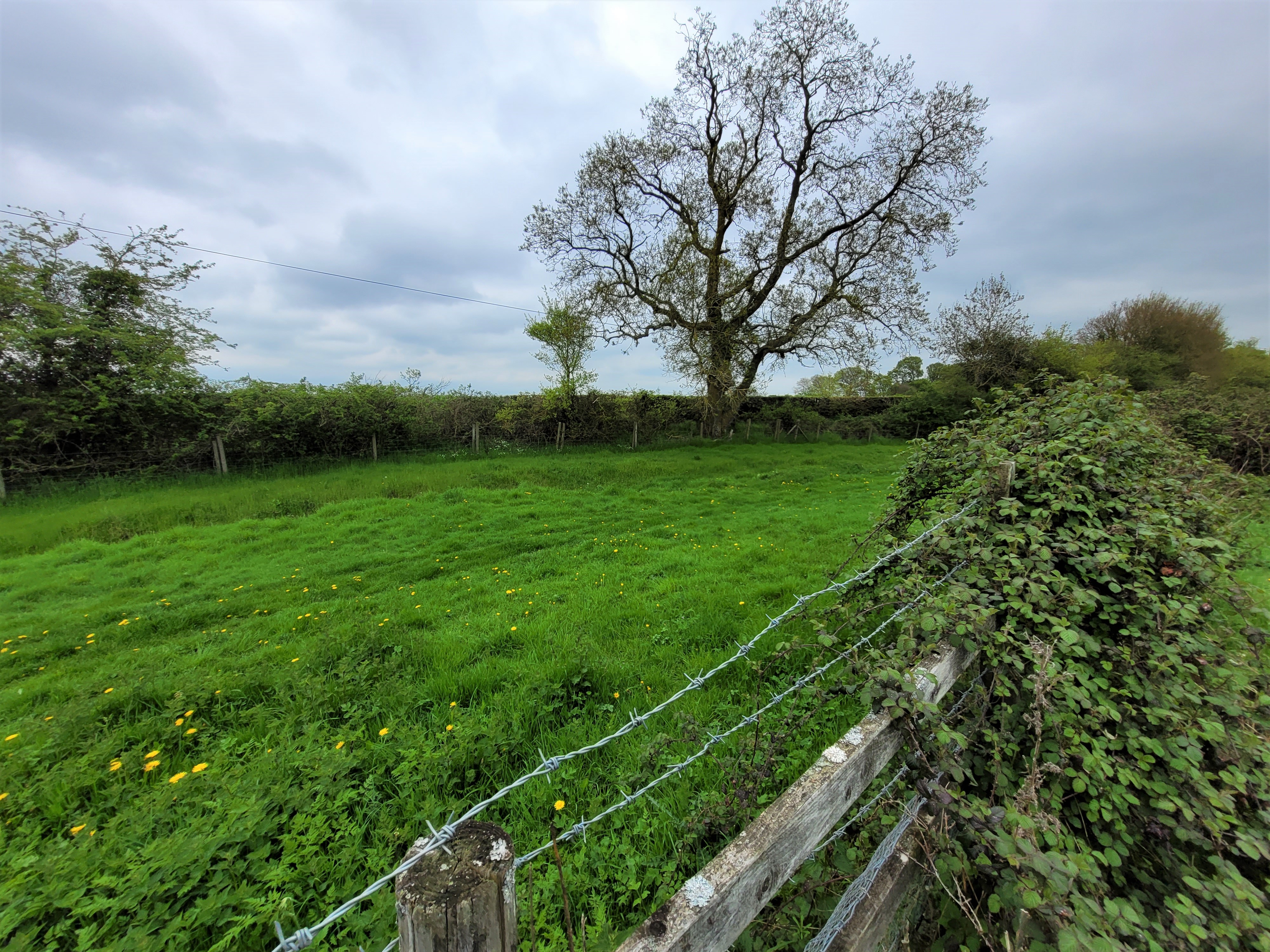
Continuing along the northern rampart we made our way towards Point 2, the amphitheatre, whilst taking time to look across the fields to our right to see the ramparts of the eastern wall beyond, whilst imagining the view obstructed by the houses, shops and public buildings that would have occupied the area back in the second and third century AD.
 |
| Following the path from the north gate towards the amphitheatre |
 |
| The view of the eastern rampart across the fields once occupied by the town buildings of Roman Silchester. |

The main centre for Roman entertainment in towns and cities across the empire would focus on the amphitheatre and Calleva Atrebatum was no different, with its stadium designed to accommodate between 3,500 to 7,250 spectators.


Amphitheatres were typically used for gladiatorial contests, wild beast fights and public executions, and horse bones excavated here suggest equestrian events were also staged.


Silchester was likely abandoned around 550 to 650 AD after the Roman evacuation of Britain in the 5th century and a new medieval village was established close to the east gate, listed in the Domesday Book in 1086 as Silcestre, surviving on into the early medieval period and likely falling into disrepair and desertion around 1400 in the wake of the Black Death in 1348.
During the 12th century an aisled hall was built in the arena and a palisade erected on top of the banks, with the fortification tentatively identified as the Castellum de Silva, (small castle in the woods) recorded to have been taken by King Stephen in 1147 during his wars with Empress Matilda.

From the amphitheatre we made our way to the only remaining part of medieval Silchester, namely St Mary's Church, largely 12th century, but with a fragment of a Norman font inside.
The path back into the old Roman wall gave us a chance to see the remains of the fortification from the outside and this aspect reveals what a formidable structure it must have been based on the remains of that are still to be seen standing.


The large tomb seen above proved to be one such interesting monument, to General Sir Edmund Haythorne KCB who with further research was found to have led a very full life, serving the British Empire in the 19th century, dying at the grand old age of 70 in 1888.
 |
| General Sir Edmund Haythorne KCB (Knight of the Bath), pictured here in 1860 as Captain Superintendent of Police in Hong Kong. https://en.wikipedia.org/wiki/Edmund_Haythorne |

 |
| The 98th Foot in action at the Battle of Chin Kiang Foo, 21st July 1842 |
In 1849 his career had continued to progress as he became aide de camp to General Sir Colin Campbell during the Second Anglo-Sikh War, seeing action at the Battle of Chillianwala in January 1849 and the Battle of Gujrat in the following February, later rising to the rank of major in the 98th Foot in 1853.

In October 1854 he was serving as a brigade-major of the Highland brigade at the Battle of Balaclava under Sir Colin Campbell.
 |
| The Thin Red Line - Robert Gibb Campbell's 93rd Highlanders repel the Russian cavalry. Major Edmund Haythorne was acting brigade major for the Highland brigade during the Battle of Balaclava. |
After the evacuation of the Crimea he returned home, before proceeding to Hong Kong in command of the second battalion of his regiment, later becoming Chief of Staff of the army in north China and taking on full responsibility for this force until the arrival of Sir James Hope Grant in March 1860, being mentioned several times in dispatches and recognised by the Secretary of State for War, Lord Herbert when proposing a vote of thanks to the China troops.
He would later become adjutant-general in Bengal from 1860 to 1865 before retiring in January 1866 on half pay, rising to the rank of major-general in 1868 and full general in 1879 and appointed Colonel of the 1st battalion Hampshire Regiment (late 67th Foot).

Following our distraction by the delights of St Mary's Church we set off to our next part of the walk, namely the south gate at Point 4 along our route.


The walls along this section are some of the more substantial remains and walking along the outside of them instead of along the top rampart gave a great impression of their imposing height, especially when you added in all of the structure that is now missing, with the illustration above helping to complete that impression.


Whilst making our way along this section of wall it was interesting to stop occasionally and look out over what is now pastureland but what was the interior network of streets and buildings that made up the Roman town, with our position along the circumference gauged by the spire of St Mary's peeking above the farthest line of trees, as seen in the picture below, to the right of the dark green tree left of centre.

 |
| This section between Point 4 and 5 on the map above becomes very wooded with the wall on the right of the path. |
 |
| As we came out of the woods at Point 5 we could see the progress we had made with a glimpse of the south gate just left of centre in the picture |
Just past Point 5 on the western wall the path reaches a junction with 'the drove', the central path that passes through the centre of the site, headed towards the small farm next to St Mary's Church, passing close to the centre of the town and the forum, and so we diverted up here to get a different view of the layout from its centre.
The view below is looking across the place that was the forum of Silchester, as seen in the header to this post, and in the illustration below, with the south gate beyond.

In the field on the opposite side of the drove to the forum is the area where Reading University has been leading much of the excavation work and from which many of the finds discovered can be seen in Reading Museum, a few of which can be seen below from the information board.


The walk around Silchester provided a fun end to our weekend in London and together with the weather and time of year made for a nice way to break up our journey back down to Devon, together of course with a quick visit to the Calleva Arms in the modern day village of Silchester as we made our way to the M3 and home.
 |
| https://www.callevaarms.co.uk/ |
As mentioned at the top of the post, you can read the posts covering some of the other Roman adventures here at home in the links to the posts below;

Next up, more ships getting closer to launch with some additional third rates of renown for Jack and Bob's collections and a look at Australia's Red Centre, as Carolyn and I head for the centre of the Australasian continent.
More anon
JJ
Thanks for that - a thoroughly absorbing post. I've never been to Silchester but will now look for opportunities to make a detour to visit in the future.
ReplyDeleteAlways exciting to see people talking about Silchester! Your post brought back many happy memories of cycling there as a child to climb on the walls.
ReplyDeleteHi Chaps,
ReplyDeleteThanks for your comments, and glad you enjoyed the read.
Silchester made a very nice break from the drive back to Devon and adds to the picture of Roman Britain that visits to this and other sites across the country help to form in one's minds eye when imagining the layout and organisation of the territory back in the early first centuries of Roman occupation.
Cheers
JJ