

The adventure in New Zealand continued when we left North Island for South Island on the 25th November, catching the ferry across the Cook Strait from Wellington to Picton, a three and half hour boat trip across one of the most unpredictable stretches of water, weather wise, anywhere in the world, and I speak as a seasoned traveller of the Channel, a similarly unpredictable if somewhat shorter hop, made much more accessible these days by the Channel Tunnel.
That said we had the most flattest of crossings and with a new hire car awaiting us at Picton, we were soon on the road to our first base of operations, Nelson (1), and then it occurred to me, Wellington, Picton and Nelson! I thought there was something very familiar and reassuring about this place for a British Napoleonic Wargamer.
 |
| Map of our travels over four weeks through South Island with the numbered areas designed to help follow our route and the places visited. - Courtesy of Backpack New Zealand http://www.backpack-newzealand.com/ |
As with North Island we had a lot of stuff to see and do planned in to our four and a bit weeks touring, that would see us back in Christchurch for Christmas and so, to give you a flavour of our little adventure, I thought I'd follow a similar format to my posts covering North Island, looking at very specific subjects with an overview, and the map above breaking our journey up into the specific legs, with this post giving a broad overview of our trip as a whole, with posts to follow looking at some specific visits and themes to conclude with.
South Island is very much about the great outdoors, bringing together stunning alpine and fiordland scenery with New Zealand's very unique flora and fauna, that served as the classic backdrop for Peter Jackson's interpretation of Middle Earth, alongside the British frontier, or 'wild-east' of the mid to late nineteenth century as miners of gold and coal flocked to some of the remotest parts of the known world to exploit the mineral wealth, alongside whalers in pursuit of Right and Sperm Whales and their oils that kept the lanterns burning back home and the ladies corsets nice and tight.
 |
| A panorama of the town of Nelson, seen from the 'Centre of New Zealand Monument' from where the first geodetic survey of New Zealand was carried out by John Spence Browning, the Chief Surveyor of Nelson |
Our drive to Nelson should have been direct and relatively quick along Route 6 from Picton until we discovered that the road was closed due to landslips caused by recent heavy rain, which required us to take a much longer, circuitous drive along Route 63, before cutting back north towards the town.
 |
| Our route for our three day hike on the Abel-Tasman Coastal Path, with a boat trip from Kaiteriteri to Totaranui and out three leg walk back to Marahau. https://www.abeltasman.co.nz/multiday-trips/walking-trips/3-day-guided-walk/ |
Nelson was to serve as our stayover for five nights to allow us to complete a three day, thirty-one mile hike along the Abel-Tasman Coastal Path, just along from the town, courtesy of Wilsons Abel-Tasman 3-Day guided walk, with overnight accommodation arranged between legs, together with dinner and breakfast and your luggage transferred to leave you to just enjoy the walking.

As well as laying claim to being the centre of New Zealand, the town also has the honour of being the birth place of New Zealand Rugby Union, with the first game being played here on the 14th May 1870, between a Nelson club team and Nelson College, this after one of Nelson’s founding fathers, Sir David Monro had sent his 16-year old son Charles home to finish his schooling at Rugby in 1867, with the young man, on his return, persuading the local football club to ditch the round ball and to start picking it up and running with the thing instead, following the rules of William Webb Ellis.

In the 1870’s it was decided to connect up all the independent surveys made of New Zealand in the early days of European settlement into one geodetic survey taking into account the curvature of the Earth, to be conducted by John Spence Browning, the Chief Surveyor of Nelson who used the top of a nearby hill to use as his central survey point.
In 1962 the centre of New Zealand was more precisely defined to several miles south west of the town in the Spooners Mountain Range, but given its historical precedence the Centre of New Zealand monument is as good as, and the views from the hill over the town were simply stunning.

However Nelson as a settlement started 700 years ago with the Maori, with today, eight recognised tribes in the north-west region.


There are some lovely beaches close to the town on the Tasman Sea and when we stayed the weather was glorious and the beaches packed with locals and the smell of barbecues wafting in the air from the dunes.

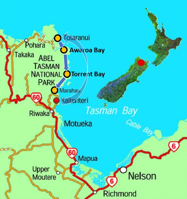
The day arrived when we were picked up from our hotel and driven to the Wilson’s main offices for our pre-walk briefing, and placing of our two-night over night bags onto the truck that would carry them on to our overnight accommodation, whilst we boarded another mini-bus for a drive to Kaiteriteri to meet the boat that would take us on a guided cruise along the coast to be dropped off at Totaranui, prior to us making a short eight mile walk to Awaroa Bay where we were to stay the night in a reconstructed version of the first house that occupied the sight, close to the beach, lived in by a relative of the Wilson family adding an interesting connection to our stay, with a presentation of its history after dinner.
 |
| The Split Apple Rock, a granite rock with a fault that has been exploited by the sea to cause an almost perfect split, a very famous tourist attraction, accessible at low tide. |
Whilst enjoying the sites from the boat, any quick observation of the nearby coast we were due to walk along over the coming days soon revealed the amount of rain water that the area had had in recent months with the scars of land slips obvious along its length and soon revealed on our walk; with the hastily redirected paths often having to climb steeply instead of the previously flat paths, making the trek a lot more physically challenging than it had been and explaining why the path had been closed to visitors for quite some time whilst the repairs were completed.
 |
| A feature of our trip through South Island would be a regular sighting of these furry chaps - Fur Seals, slaughtered remorselessly in the 19th century for their pelts, now seemingly making a strong recovery in the 21st. |


 |
| The house, Meadowbank, at Awaroa Bay, our first night’s stop over on our three day walk and a beautifully reconstructed settlers house built in 1884 and occupied by William and Adele Hadfield, Adele being the great-grandmother of the business owner’s wife |
The next morning we were off on our trek proper, with two legs of walking, of ten and eleven miles a day over the next two days, exploring some of the most beautiful parts of the South Island coastline, clad in native bush and trees with our guide stopping occasionally to explain the significance of particularly fine examples of the fauna and flora along the way, whilst we enjoyed gloriously fine warm weather throughout, together with getting to know our small group of fellow walkers.


After a day and half of even more stunning bays coming into sight around the next corner you started to forget how amazingly beautiful a part of the world you were so lucky to be enjoying, before stopping and just resetting the mind and eye to really appreciate the view and appreciate it properly.


These little chaps, with young in tow, were frequent visitors to our stop overs, looking to take advantage of any item left accessible to them and unobserved, as we were well briefed on their ability to steal anything and run off into the bush with it before you could do much about it.
 |
| Weka were a frequent visitor to out refreshment stops. |

The gateway into the Abel-Tasman National Park at Marahau Bay marked the crossing line and end of our amazing three day expedition that both Carolyn and I thoroughly enjoyed and from which we take lots of very special memories of the sights and lovely folks we met during our time in this very special part of the world.


The name Kaikoura comes from the Maori, meaning ‘meal of crayfish’ with as well as the legend of Maui placing his foot on the Kaikoura peninsula to steady himself whilst fishing up the North Island also references the wonderful crayfish to be be had in this area of coastline.
Captain Cook discovered the Kaikoura peninsula in 1770, mistaking it for an island, reporting seeing four double-hulled canoes approaching the Endeavour containing some fifty-seven Maori, which might have convinced him to keep on sailing!

A whaling station was established in 1842 by Robert Fyffe and his original house can still be seen today just outside of the modern day town, serving as a remarkable monument to the founding of the place and its history linked then and today with the whales that frequent the coastal waters due to the geography of the place that sees the continental shelf here drop vertically over 3,000 feet.


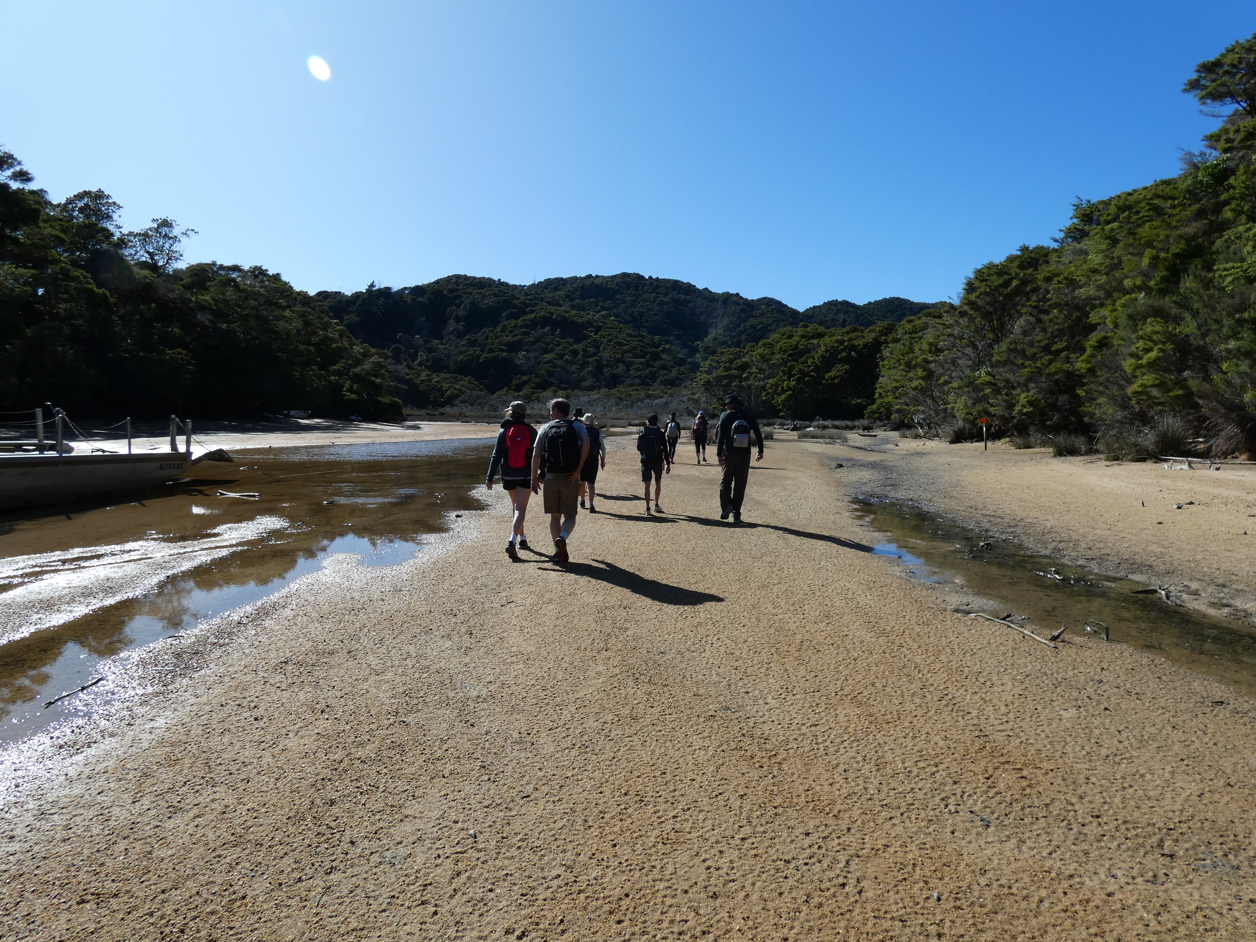
Sadly despite waiting a day for a trip to come available, the sperm whales didn’t come out to play which resulted in a refund of our fee, which was very fair, and with the trip not entirely unsuccessful with my seeing a hump back whale off the beach close to the boat booking office, plus plenty more examples of the local wildlife
 |
| Whilst waiting for a boat booking to become available, I noticed something going on in the water close to the carpark that was later identified as a hump back whale, doing its stuff. |
 |
| A fine looking fur seal off Kaikoura |
 |
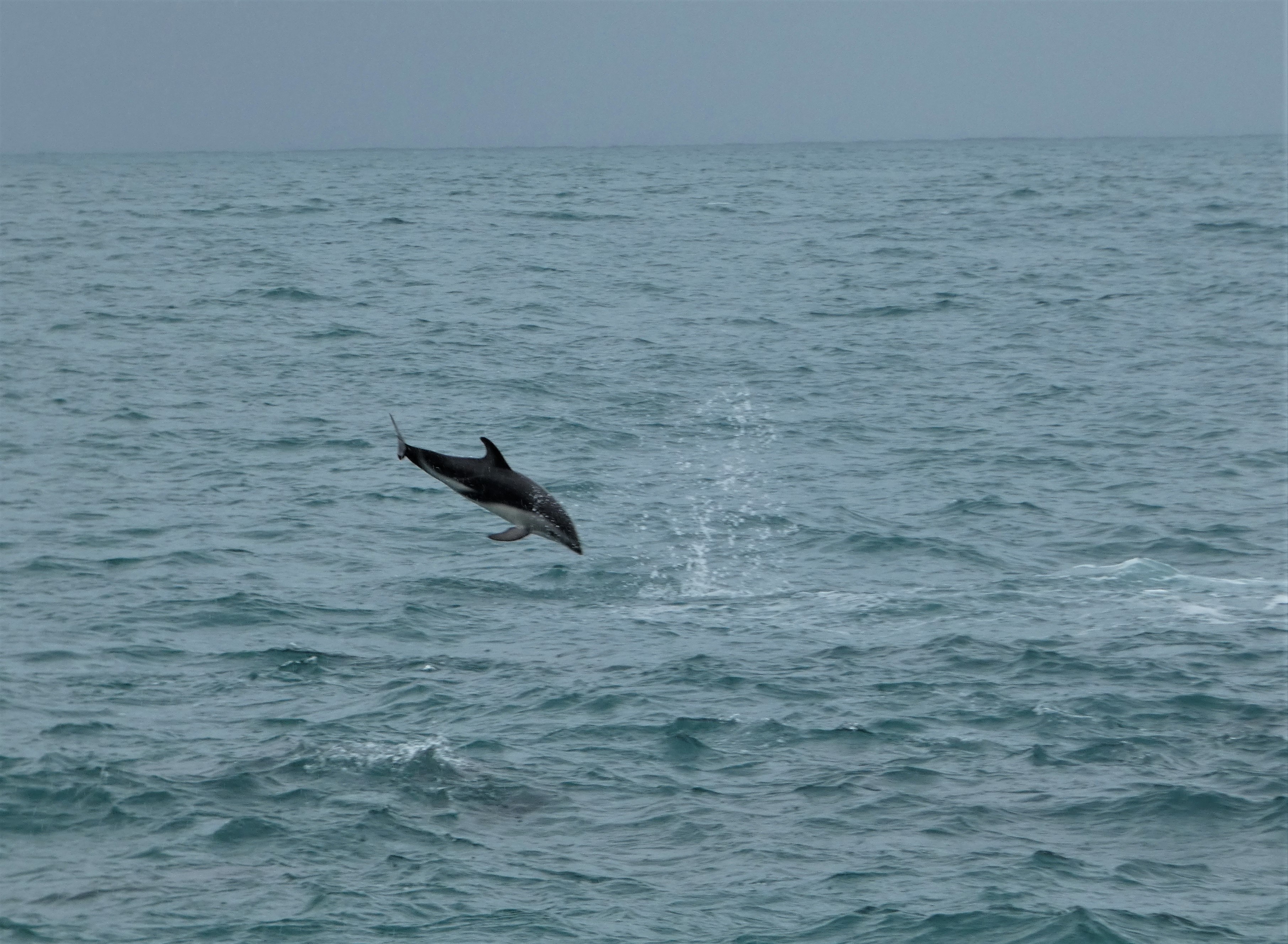
| New to me, this pod of dusky dolphins joined our little whale-watching expedition with an amazing display of marine acrobatics. |
 |
| Another delight was to see this Southern giant petrel cruising along close to our boat |
 |
| Mollymawks, a medium size albatross were also great to see cruising the waves during our abortive whale watch. |
 |
| Taking it for the team, yet again, I go the extra mile and sample the extraordinary crayfish at Nins Bin. |
 |
| An Australasian Silvereye I caught dipping into a flax flowerhead for the nectar as discussed below |
These birds are simply the good old fashioned House Sparrow that like to take advantage of the nectar in the red and yellow flowers of the Flax that grows in abundance in NZ.
To get at the rich sugary liquor that is revealed by peeling open one of these flowers, the sparrow and starling have to dig deep, that sees them ending up with the orange pollen crest seen on the chap below and I have since observed them doing just this - the mystery bird sub-species solved!
 |
| Not a new species but a normal NZ male house sparrow that has been rummaging around in flax flowers. |
From Kaikoura the journey continued south with our first visit in the month planned for Christchurch (3), where I had the pleasure of scratching the wargaming itch with the Christchurch Wargaming Club - link below to the post covering the day.
 |
| JJ's Wargames - Christchurch Wargames Club |
However, again on the way to one destination, time was taken to stop to take in another, which this time was a pilgrimage to the town of Amberley amid the dairy pastures on the Canterbury Plain to pay homage to a great New Zealander in war and peace and the rather stunning bronze statue to the great man created by Mark Whyte in 1997.


'. . . perhaps the lasting memory will be of a man who had forthright views but an ability to discuss issues with anybody. Charles Upham was a shy, courageous, determined man whose principles are an example to everyone.'


The history of the city shows the area originally occupied by Maori, from possibly as early as 1,000 AD, with the first Europeans settling there in the 1840's, with the French starting a neighbouring settlement at Akaroa.
In March 1848, the Canterbury Association founded by John Godley, consisting of Members of Parliament, Peers and Anglican Church leaders met to lay out plans to establish a colony in New Zealand with a programme of organised emigration, starting in 1850, with the new colony to be called Canterbury and its capital, Christchurch in honour of John Godley's alma mater, Christ Church College, Oxford University.
The plan would see some 3550 settlers arrive in twenty-five ships, between 1850 and 1853 and the first four ships Charlotte Jane, Randolph, Sir George Seymour and Cressy arriving in December 1850.
On the 31st July 1856 the city was granted its Royal Charter, making it officially the oldest established city in New Zealand.

This destruction has created the city scape seen today with an ongoing project to replace many older iconic city buildings with new, earthquake resistant ones, often requiring foundations dug to a depth of some 100 feet and the incorporation of rubber shock absorbers and gaps between buildings to help counter the shock from massive tremors, whilst alongside this work, huge expenditure has been committed to save irreplaceable landmarks such as the Anglican cathedral, and the old gothic buildings of the former university.
 |
| The once proud symbol of the links of empire, the post and telegraph office, with its royal coat of arms adorning the front entrance, is now a 'Hogwarts' inspired café which we frequented for breakfast, complete with the pneumatic powered tubes across the ceiling of the building linking every table with the kitchen once used to carry money and documents, and now for delivering orders for hamburgers and fries to the table in sealed capsules. |
 |
| Christchurch was and is still an important link in the route to Antarctica with the early days of exploration seeing it used as a port of departure for the likes of Shackleton and, as seen here, Captain Robert Falcon Scott RN, who died with his team in the failed attempt to be the first expedition to reach the South Pole in 1912. |
 |
| Even Captain Scott, bears the scars of earthquake damage, with pins observed in his legs holding things together. |
 |
| The Anglican Christchurch Cathedral was severely damaged in the 2011 earthquake, with the remains of its tower demolished in 2012. Design and stabilisation work commenced in 2019 after a lengthy dispute between church and other interested parties, when the church decided to demolish the old building entirely and start anew. Monies are now being secured and provided by local government to reinstate the original building. |
 |
| Even the commanding statue of the city's founding father, John Godley in the central square outside the cathedral bears the scars of earthquake damage, deliberately still displaying his flattened head after it fell to the ground and was later repositioned. |
 |
| Japan has been subject to the ravages of earthquakes, being similarly placed on the 'Pacific Rim of Fire' and this piece of wall art nicely captures that link, by Japanese artist Koryu, depicting the two guardians of the gods, known as Nio, now sent to protect Christchurch. |
Whilst in Christchurch we used our new base to explore other local sights, one of which included a day trip out to Mount Sunday, another location used by Sir Peter Jackson as the location for the Rohan Golden Hall of Edoras.
 |
| Mount Sunday, another Peter Jackson location, recreating the Golden Hall of Rohan in Lord of the Rings |


The scene was not planned, but still kept and adapted into the end film, and the wind was as strong the day we visited as depicted in the film, as evidenced by Carolyn and me desperately clinging to a similar banner and our hats as well.

 |
| Further up the valley from Mount Sunday about centre line of my picture is the location for where Aragorn, having survived his fall with his horse into the river below, after his fight with a Warg rider, stops to look across a wide river drift (the jutting out piece of ground to the right of picture) to observe Helms Deep on the opposite bank (the slight indent on the opposite slopes on which a CGI of Helms Deep was created. |

 |
| Below, looking towards another valley side from Mount Sunday, is the ground over which Gandalf rode with Pippin to Minas Tirith on Shadowfax and announced to Pippin that they had just passed into Gondor. |
This little adventure during our stay in Christchurch was our first taste of the grandeur that the alpine interior of South Island had to offer and needless to say we were both keen to be back on the road to discover more.
 |
| As we moved on into alpine country, the edges of the road seemed to shimmer with a pink and purple haze, that soon revealed, on closer inspection, the grandeur of lupins, considered a weed by locals, but marvelled at by tourists, pulling into river valley laybys to take pictures of the blooms. |
Our next stop was Twizel (4), pronounced 'Twy-zel' as we were originally corrected, located close to the bottom end of Lake Pukaki well into South Island alpine country, so much so that we stopped off close to Lake Tekapo to indulge ourselves with a bit of fixed wing flying and a quick spin around the literal top of New Zealand, Mount Cook and its surrounding glaciers and peaks.
 |
| Our Gippsland Aeronautics GA8, 300hp aircraft, flown by Justin, our pilot from Air Safaris, was the perfect mount for getting great views from the cockpit as we got in close to the peaks below |
 |
| How about that for a view from the office window! |
 |
| The top of New Zealand - Mount Cook at 12,217 feet is the highest and most famous peak in NZ, known to the Maori as Aorangi or Aoraki, translated as 'Cloud Piercer', this marvellous mountain is surrounded by over 150 other spectacular peaks. |
In the second part to this post, I'll conclude this overview of our road trip around South Island.
In the meantime, with New Year fast approaching, Carolyn and I are looking forward to an Australian style New Year celebration accompanied by fireworks on the banks of the River Yarra and Melbourne.
May I wish everyone a very happy and peaceful New Year in 2023.
More Anon
JJ
Another wonderful post - you have now officially been to a lot more places in the S Island than I! In fact, apart from a couple of work trips, we have only had one real S Island visit in 35 years and that was to Queenstown and environs in May 2022! Its something we need to work on rectifying in the next few years!
ReplyDeleteFantastic mate, great memories for me. I do love the South Island and have many rugby mates there who I played with in the eighties especially in Nelson and Dunedin (where I played Rugby in the snow….)
ReplyDeleteLove the Peter Jackson Locations, in 2008 with my family we toured a number of the sites in New Zealand after my eldest and myself competed in the World bagpipe championships.
I doubt it has changed much since then
Happy new year mate, all the best for 2023
Cheers
MattW
Hi Chaps,
ReplyDeleteThanks for your comments and glad you enjoyed the read. Plenty more stuff to look at in the second part to this post, but I thought I would focus next on an amazing location we found on our route through Marlborough country.
More anon
JJ